The 360° panorama with 3D integration is the most advanced technique for showcasing a real estate project within its actual environment. We integrate your 3D renderings directly into 360° aerial or ground-level photography, creating a unique immersive experience where your future building appears as if it were already built.
The 360° panorama with 3D integration offers an immersive and realistic visualization of your project within its existing environment. It facilitates decision-making by providing a complete perspective from all angles, even before construction begins.
Offer your clients an immersive experience by allowing them to navigate freely through the project and explore every detail from every angle.
Visualize precisely how your project integrates into its existing environment, thereby facilitating decision-making and necessary adjustments.
Present your ideas clearly and convincingly, replacing hundreds of 2D photos with a single interactive panorama, which reduces documentation time and improves collaboration among stakeholders.
Our panoramas are compatible with computers, tablets, smartphones, and virtual reality headsets, offering maximum flexibility for your presentations.
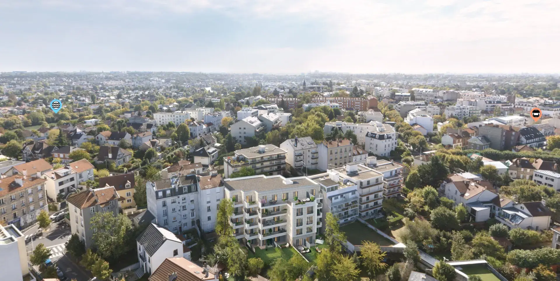
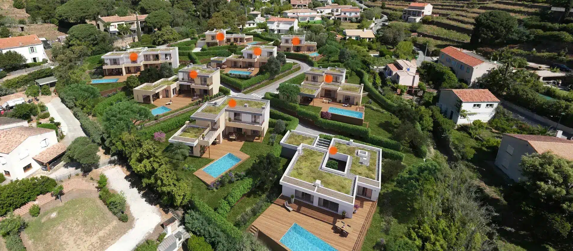
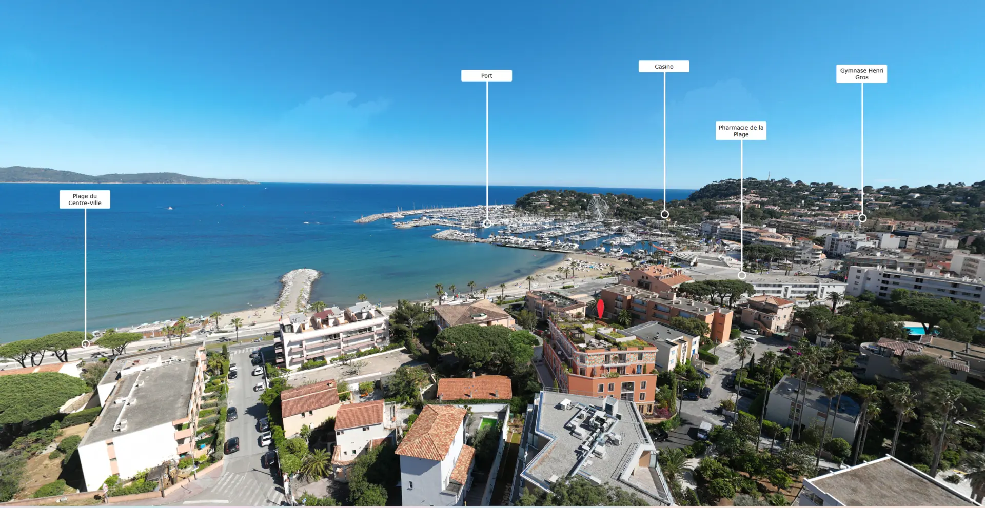
Unlike a simple 3D virtual tour, a real estate 360° panorama integrates your project into an actual photograph of the environment. We take a 360° photo of the real location of the site or neighborhood, then insert your 3D-modeled building into it with photorealistic precision.
The result: your prospects can see exactly what their future home will look like from the street, from neighboring buildings, or from any other viewpoint. It is the most compelling tool for resolving any doubts regarding the architectural integration of a project within its neighborhood.
The 360° panorama with 3D integration is particularly effective for real estate developments in urban areas where integration into the existing fabric is a key challenge. It is also widely used for building permit applications, presentations to local authorities, and public inquiries.
Our developer and architect clients use this format to: present a project during a city council meeting, reassure local residents during public consultations, differentiate their development on real estate portals, and illustrate the visual impact of a project from the neighborhood's main vantage points.
From the 360° photo shoot to the delivery of the panorama with your integrated project
We take a 360° photograph of the site or neighborhood from strategic viewpoints defined in collaboration with you.
We model your building in 3D based on your plans with complete architectural precision facades, materials, vegetation.
The 3D model is integrated into the photographic panorama with meticulous attention to light, shadows, and reflections to achieve a perfectly realistic result.
You receive an interactive 360° navigable panorama, accessible via a URL link on all devices computer, tablet, smartphone, and VR headset.
Everything you need to know before ordering your panorama
The 360° panorama integrates your 3D project into an actual photograph of the existing environment. The 3D virtual tour is entirely modeled in 3D. The panorama is more realistic for showing integration into the neighborhood, while the virtual tour is better suited for exploring the interior of the units.
Yes, we need to travel to the site to perform the 360° photo shoot. We operate throughout the PACA region and across France depending on the project. Aerial drone photography is also available.
Yes. 3D photographic insertion within a 360° panorama is a highly valued document for urban planning departments to assess the visual impact of a project on its environment.
Allow 1 to 2 weeks after the on-site photo shoot. The lead time depends on the complexity of the project to be integrated and the number of requested viewpoints.
Yes. We can create a multi-viewpoint panorama with navigation between different locations from the street, from a height, or from the development's entrance. Contact us for a tailored quote.