Have you heard of drone photogrammetry? This 3D modeling method transforms 2D images into 3D models. It measures the dimensions and volumes of a scene to obtain precise, high-quality 3D renderings.
Used in architecture, civil engineering, archaeology, forensics and real estate, this technique has reinvented digital visualization. Photogrammetry represents a major advance in 3D modeling for the real estate sector.
Find out more about the advantages and applications of this technique in the real estate sector.
What are the advantages of photogrammetry for 3D real estate models?

Drone photogrammetry makes a major contribution to the development of the real estate sector, thanks to its innovative processes. 3D modeling of real estate projects is cheaper, faster and more accurate.
Reduce modeling costs
In general, the cost of 3D modeling is a major investment for real estate professionals. Using drone photogrammetry is one way of reducing these costs.
In fact, this technique doesn't require any sophisticated equipment, as a drone with or without a camera, a camera or a smartphone may suffice.
In fact, photogrammetry consists in determining the measurements and volumes of a space from simple 2D aerial images. These are then assembled using software to produce a 3D projection of the scanned area. Photogrammetry software has the advantage of being affordable.
What's more, drone photogrammetry provides easy access to remote, dangerous or hard-to-reach areas. Able to fly at high altitudes, the drone is an alternative to terrestrial photogrammetry.
Simply operate it remotely to collect information about the land or building. This eliminates the need to invest in expensive surveying equipment.
Workflow optimization
Photogrammetry makes it possible to automate tasks, considerably speeding up the 3D modeling process. What's more, it only takes a few steps.
Taking images of the property
Before creating a 3D model, the drone will first take images of the same scene from different angles. This process is accelerated by the drone's automatic flight. What's more, they can process large surfaces in a short space of time.
Aerial image stitching
The next step is to assemble and import the images obtained with the help of processing software. Make sure that the camera you're using is compatible with the software.
3D model creation
The photogrammetry software automatically recognizes the coded targets needed to align the images and determine the model's orientation. This is the image matching stage.
This is followed by feature extraction, which can be fully automated. This is a real time-saver for modeling.
Triangulation
This process takes place automatically, transforming photos into 3D point clouds. These are used to build the 3D mesh or model of the scene. The texture is then added to the 3D model of the property.
Finalization
The last step is to make the final adjustments in order to obtain a quality result. More specifically, irregularities need to be cleaned up using post-processing software. Finally, the file can be 3D printed or imported into CAD software.
Photogrammetry software makes everything fully automated. Not only is it easy to use, it's also affordable for the general public.
Improved accuracy of 3D models
Drone photogrammetry relies on human perception to provide reliable, accurate data.
Principle of human perception
Photogrammetric 3D models are remarkably accurate. This technique is based on the principle of human vision of relief through stereoscopic observation. This means it uses two distinct points of view, similar to a left eye and a right eye.
This enables depth and relief to be visualized. It also captures RGB visuals, enhancing image aesthetics and textures.
Accurate data
The photogrammetric technique involves collecting precise data on the measurements, distances and heights of the site, building or project under construction. Measurements are taken on the final images through the orthorectification process.
This information is used to generate high-quality 3D renderings, avoiding inaccurate visualizations. For developers and real estate agents, this high level of precision ensures a better customer experience for their prospects.
When should photogrammetry be used for real estate visualization?

In real estate visualization, photogrammetry can be used for communication and project planning.
Creation of immersive virtual tours
Drone photogrammetry can be used to create immersive virtual tours of a building based on photorealistic 3D models. A virtual tour is a three-dimensional projection that provides a 360° view of a property.
The visitor can see all the details of the room, such as wall color, flooring and furniture layout. Sometimes, they can also move around the different rooms in the complex.
Potential customers can visit the complex wherever they are, from their PC, smartphone or tablet. The use of photogrammetry enhances the accuracy of the virtual tour, increasingvisitor engagement.
For outdoor virtual tours, drone captures offer a visualization of the building's environment and overall ambience.
Photogrammetry can be combined with other techniques to achieve even better results. Lidar technology, for example, can project its own light, making it possible to work in the dark.
This is an option that photogrammetry does not have. You can also use other software to add additional options. For example, add an option to move objects or delete certain elements, thus creating an interactive virtual tour.
Promotion and sale of real estate
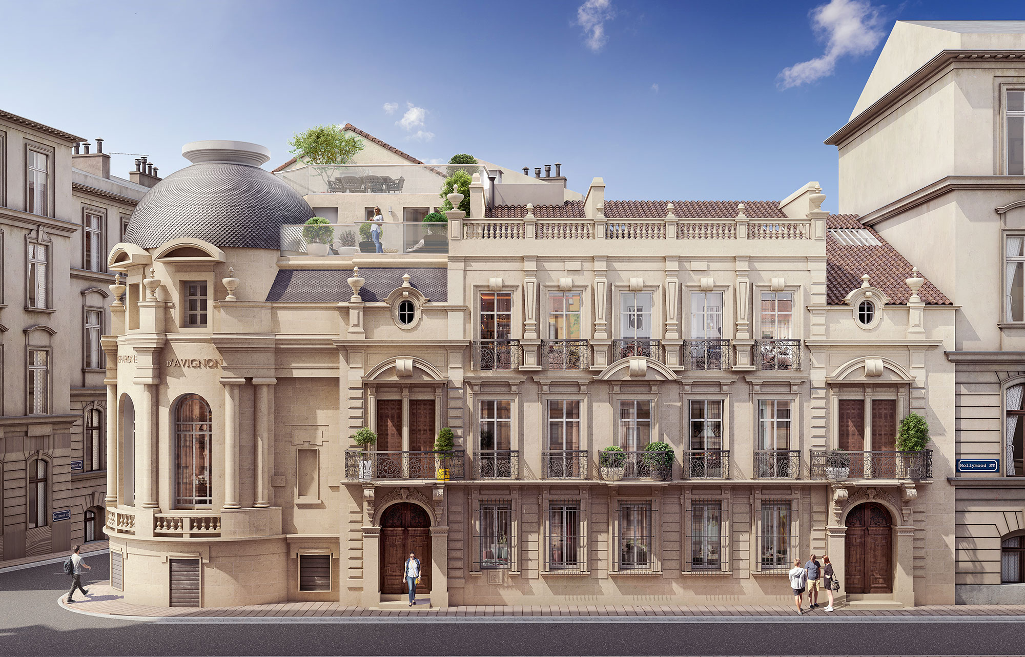
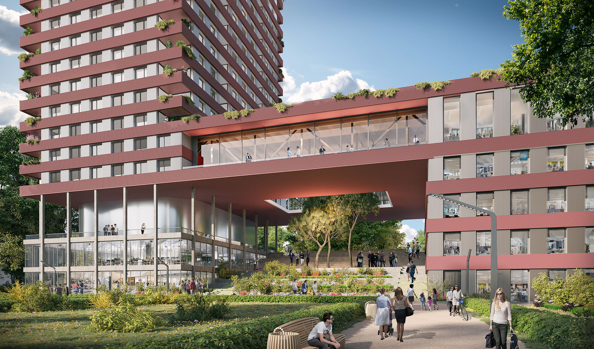
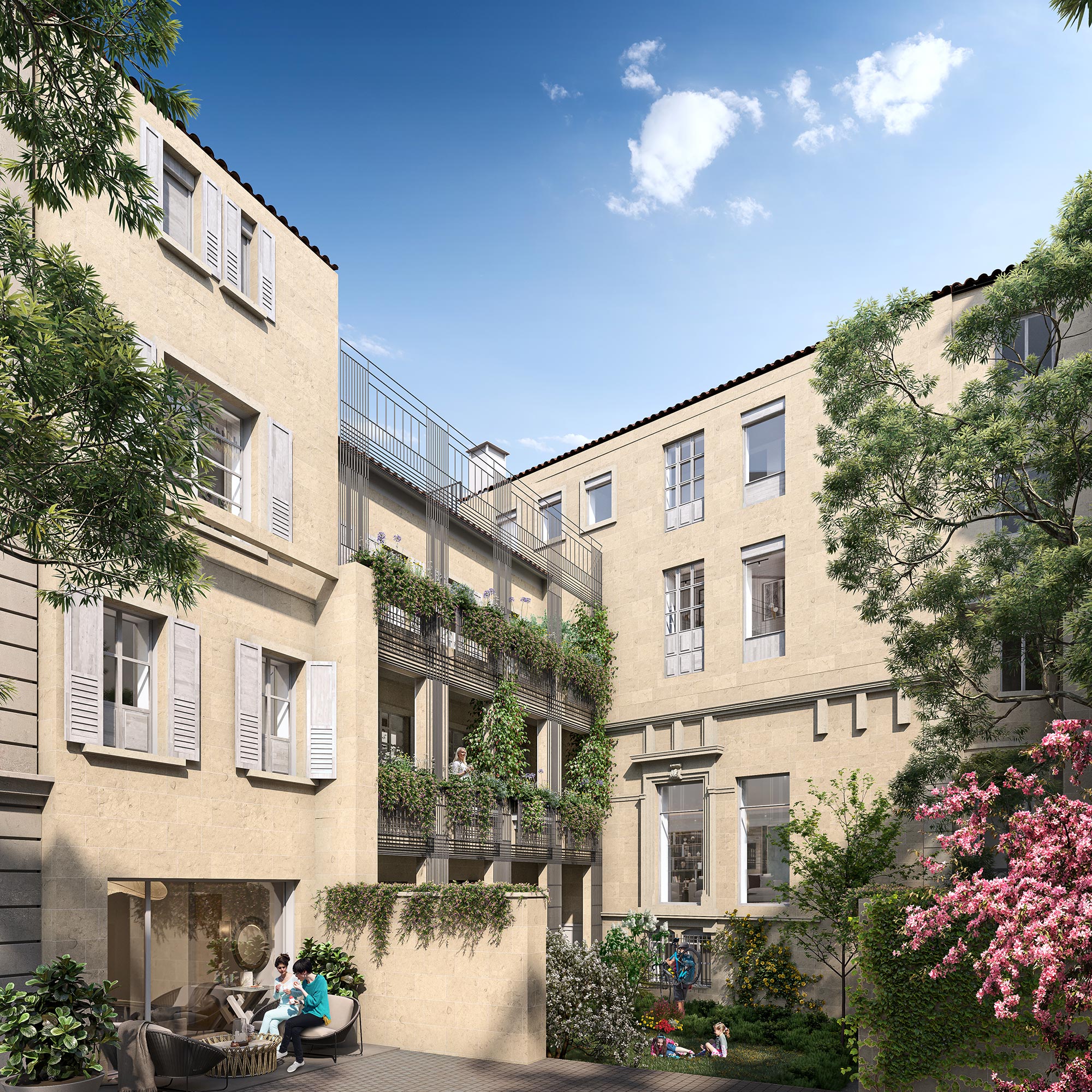
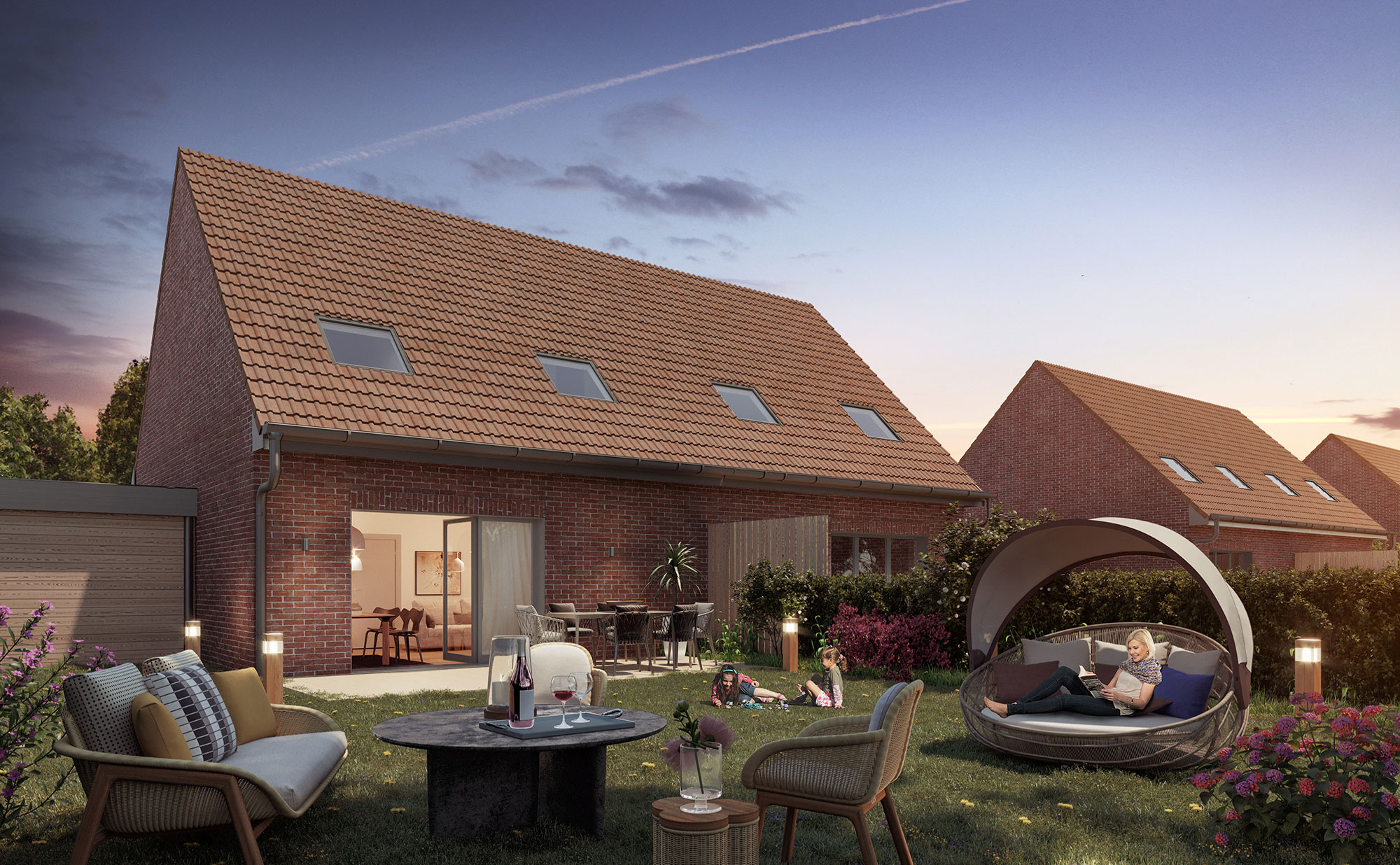
In the digital age, real estate professionals can no longer do without 3D solutions to promote their real estate projects. Drone photogrammetry is capable of creating 3D images, which can be used to create 3D plans and 360° perspectives faithful to reality.
These tools enable future buyers to properly visualize the property.
These 3D renderings are now essential real estate marketing tools. Integrating them into your communication media is a winning technique for attracting more customers.
What's more, the ability to visualize all the details of the property helps customers project themselves more quickly into their future home.
Real estate project planning
Real estate visualization is important before starting any real estate construction project. You need to assess the land beforehand, gathering data on its characteristics, topography and mapping.
The detailed information obtained by photogrammetry leaves very little room for error. This precise data is designed to identify and resolve problems in the field before work begins.
The resulting aerial photographs and 3D models allow architects and builders to continually experiment to achieve the desired result. These visual tools facilitate communication between the various parties involved. This ensures better planning of the real estate project to ensure its success.
Would you like 3D renderings of your real estate project?
Let's talk (CTA)