
Property development 3D visualisation: what to show at each project stage
Feasibility, planning, launch, sales, last units: what property development 3D visualisation should show at each stage, and where orbital models fit.
By David Dana
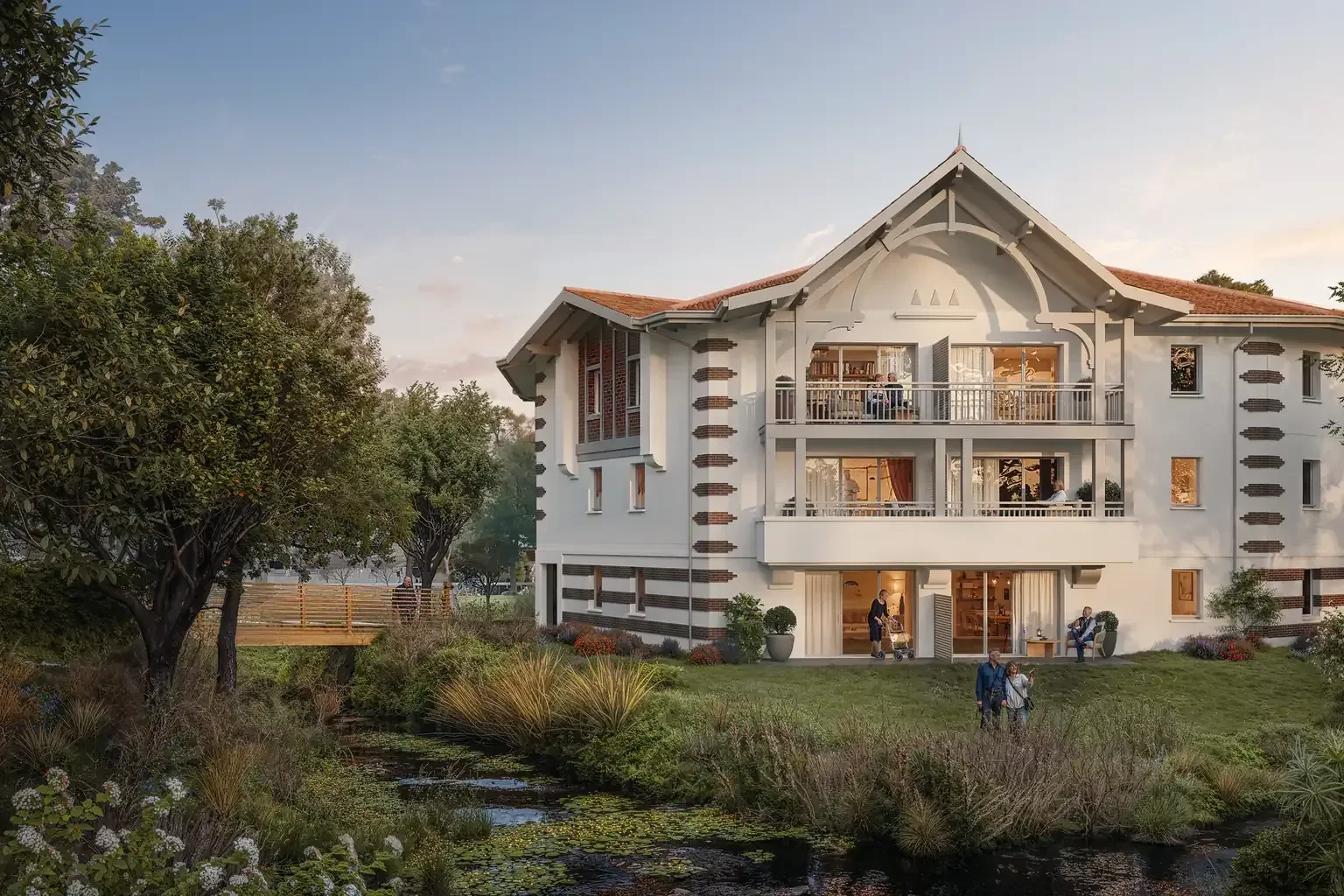
In short: property development 3D visualisation means representing a building project with a three-dimensional digital model, built from the plans, so it can be presented before it exists. The model does not show the same thing at every stage: massing during feasibility, insertion for the planning application, a neighbourhood at the sales launch, then units, floors and availability during sales. The orbital 3D model takes over when the questions become the buyers' questions: where is my home, is it still available, will it get the sun?
Between the first sketch and the sale of the last apartment, a scheme goes in front of very different people: the landowner, the local authority, partners, the sales team and buyers. Each expects 3D to answer their own question. Ordering the right visuals at the right time avoids two common pitfalls: showing over-polished images too early, or reaching the sales stage with no tool able to locate a unit.
This guide follows the project stage by stage. It does not define the orbital model again, which is covered in our article on orbital 3D models: definition and uses; it shows when the orbital model becomes useful, and what the other 3D media do before it.
Property development 3D visualisation: what it means
Presenting a property project in 3D means drawing, from a single digital model, the images, views and tools each stage needs. The model evolves with the project: a simple set of volumes at first, it gains facades, materials and surroundings, then the list of units and their status.
Property development visualisation is the broader term for the same idea: showing a building that does not exist yet to the people who must assess it, fund it or buy it.
The medium therefore changes over time: massing model, 3D site plan, rendering, film, orbital model, virtual tour. The right question is not "which one is best?" but "what does the person in front of me need to understand today?".
Project stages and what 3D should show at each
Feasibility and land: massing
During feasibility, the project is still a hypothesis: a footprint on the plot, a number of storeys, a layout of buildings. What needs showing is volume, not atmosphere. A plain massing model, with no materials or furniture, helps discuss the layout with the landowner, internally or in early talks with the local authority, without suggesting that the architecture is fixed.
This is where the site plan comes in: it shows how the land is organised, with access, gardens and parking. Our 3D site plan page presents this medium, which stays useful right through to sales.

Planning application: insertion
At the planning stage, the question becomes: how does the building sit among its neighbours and in the landscape? In France, the official building permit page lists among the required documents a "graphic document (photomontage for example)" to assess the project in relation to neighbouring buildings and landscapes, together with photographs locating the site in its near and distant surroundings (Service Public "Permis de construire" page, in French, consulted 13 November 2026).
At this stage, 3D serves accuracy more than appeal: views from public space, neighbouring buildings at their real height, planting shown as it will be planted. An insertion 3D rendering meets this need. To present the project in motion to the council or to neighbours, our article on architectural animation uses covers the options.
Sales launch: the scheme in its neighbourhood
At launch, the audience changes: buyers now discover the scheme, often on the development website or in a brochure. Before choosing a home, they want to understand where the residence is, how to get there and what surrounds it. Aerial views, the site plan and the orbital model answer that big-picture question; eye-level renderings create desire.
This is also when consistency across media matters most: the brochure, the website, hoardings and sales appointments must all show the same project. Our guide to off-plan real estate marketing places these media within the full sales process.

Sales: the unit, the floor, the availability
During sales, questions get more specific: which floor, which side, next to which unit, and which one is still available? A still image can no longer answer alone. You need a medium that moves from the whole to the detail: the entire scheme, then one level, then one home, with its status. This is where the orbital model comes in.
Through to the last units: keeping it up to date
Towards the end of sales, the remaining units are sometimes those whose floor or orientation needs the most explaining. The medium must then reflect the real state of sales: showing a unit as available when it is reserved costs credibility. Keeping statuses up to date matters as much as image quality.

Where the orbital model takes over
The orbital model is produced on computer from the project plans, then viewed online. It comes in when 3D has to support unit-by-unit sales, through four features:
- Floor-by-floor slicing isolates one level to show where a home sits in the building.
- Unit filters and availability sort homes by the criteria the developer chooses and show those still to be reserved.
- Sunlight runs the sun's path to show when a facade or balcony gets light.
- The CRM link with the developer's system updates unit status without re-entry, down to the last one.
Each answers a stage described above: sales for slicing and filters, the case for less obvious units for sunlight, the end of sales for the CRM link. These features are detailed on our orbital 3D model page, and the term itself in our glossary entry.

One model, enriched at every stage
The most efficient approach is not to start from scratch at each phase. The 3D model grows with the project, as documents arrive:
- at feasibility, the architect's sketch or digital model, the footprint on the plot and the number of storeys;
- at planning, the plans, elevations and site photos that fix the insertion;
- at launch, the material choices and the viewpoints selected for the sales media;
- during sales, the unit schedule with type, floor and status, then CRM access if statuses must sync.
Planning for this progression keeps visuals consistent from one stage to the next, and lets every image evolve when the plans change. Scope and approval steps are set in the quote, according to the stage the project has reached.
A representation, not a commitment
At every stage, 3D represents a project: it does not describe it in a contractual sense. What binds the buyer are the documents annexed to the contract. A clear notice therefore accompanies every visual shared; our article on the VEFA descriptive notice and 3D renderings explains how visuals and contract documents should line up.
Presenting your project at the right level of detail
A property project in 3D is presented in stages: volumes to decide, insertion to obtain the permit, a neighbourhood to launch, units to sell, up-to-date statuses to close. The orbital model does not come first, but once sales open it is the tool that stays with the scheme the longest.
VIZION STUDIO produces 3D site plans, renderings, films, virtual tours and orbital models from your plans; the team can also start from your architect's 3D model if one exists. Discover our orbital 3D model, then contact us and tell us which stage your project has reached.
3D services to bring your project to life
Preparing a property launch or an architectural presentation? Explore deliverables and examples relevant to this topic.
Frequently asked questions about presenting a property project in 3D
How do you present a property project in 3D before planning permission?
With volumes and a site plan rather than highly polished images: at this stage the discussion is about layout, heights and access. When the permit is filed in France, the file requires a graphic insertion document, such as a photomontage, which a rendering drawn from the same 3D model can provide.
What is the difference between an orbital model and a 3D rendering?
A rendering fixes one viewpoint chosen to show the architecture and atmosphere. An orbital model, produced on computer and viewed online, can be rotated around the scheme and taken down to unit level, with floor-by-floor slicing, availability and sunlight. The two complement each other during sales.
What do you need to provide to model a property project?
It depends on the stage: the architect's sketch or digital model at feasibility, plans, elevations and site photos at planning, material choices at launch. For a sales orbital model, add the unit schedule with type, floor and status, and CRM access if statuses must sync.
Does the orbital model update when units are sold?
That is the role of the link with the developer's CRM: a reserved unit changes status on screen without re-entry, down to the last one. This connection is planned at scoping stage, together with access to the unit data.
Do 3D images of a property project have contractual value?
No. They represent the project: what binds the buyer are the documents annexed to the contract, such as the description and plans. Every visual shared therefore carries a notice stating that it is for illustration only.
Give your project the images that will sell it
Tailor-made quote, no commitment.